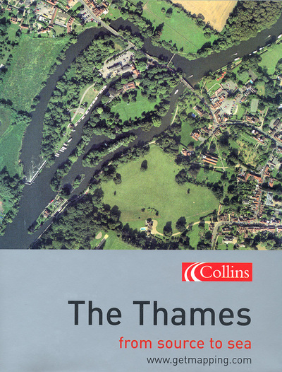
Description
The Thames is an enthralling visual walk along England’s greatest river, from its source to the sea, which combines Getmapping’s spectacular aerial photography with fascinating facts on the history, life and times of the places along the riverbank.
The Thames and the communities which lie along its banks contain an astonishing wealth of sites of historical and cultural importance and of natural beauty. Getmapping The Thames allows you for the very first time to see this astonishingly rich and diverse landscape from the air. Starting at the source of the Thames in Oxfordshire and proceeding along the river right to the estuary and the sea, the book combines Getmapping’s high-quality aerial photography with facts and pocket histories of all the places you will encounter along the way.
The pace varies too, from leisurely looks at areas of outstanding natural beauty to indepth spreads on historical ‘must-sees’ such as Hampton Court or Greenwich. From information about locks and cruising along the Thames to the dark and brooding history of the Tower of London.
240 pages of aerial photography, from the Thames to the sea
– Special in-depth spreads on Hampton Court, The Tower of London, Greenwich and other key historical sites
– Facts and figures about areas of natural beauty such as the Wetlands Centre
Getmapping The Thames is the ultimate visual companion to the life and times of Britain’s greatest waterway.